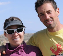
We left Glacier National Park out of the North East exit through the town called St. Mary. After traveling about 45minutes north of St. Mary, we reached the border of the US and Canada. We were stopped at customs by a female guard. I was surprised to see her standing there all alone. She asked us a number of questions including, “ What is your purpose of travel, are you carrying any bear or pepper sprays, how long do you plan on visiting, and are you planning on selling anything in Canada?” The main concern I had had was whether or not our dog Payton would be allowed in the country. We had taken care of getting all of his shots and paperwork up to date before departing. She did not even ask to see a single document! After observing our passports and requesting that we remove our sunglasses, she said, “ Enjoy your trip”.
We stayed the night in Waterton National Park, which is on the Canadian side of the Glacier National Peace Park. We had hoped that our US annual parks pass might work here, but discovered that it did not. Park entry was $7.50 CA dollars per person. This was not bad considering the US parks we had traveled to were each a $25 entry fee if you did not have the Annual Parks Pass. The site was along Waterton Lake with a beautiful view of a street corner on one side with the lake on the other. We were camping in the town site, and it felt like we were camping across the street from someone’s house. The main difference here was that there was actually a town, with local residents inside of the park. In the US, you would have had to have owned the property before it became a National Park, in order to “live” in the park.
After setting up camp, around 7pm Andy went for a short mountain bike ride while I took a SHOWER! It is a good thing that he attached a bear bell to his mountain bike (they suggest doing so anywhere in bear country, as stated in all guide books and publications we have read) because on the descent, he ran into two bears! One was a very large black bear that may have been with its cub a smaller cinnamon colored bear. The bears were 10 yards off the trail. He stopped for a minute, noticed that the road was just ahead, and he decided to go for it. The scary thing is that this part of the trail was only about a quarter mile away from where we would be camping that night.
With the town site so close, we couldn’t resist walking just about 2 blocks away to get a sample of the local ice cream. This was our first encounter with needing Canadian currency to make a purchase. Luckily there was an ATM a couple of shops away, and I was able to use my debit card to withdraw $20. There was of course one of those $2 surcharges, so the withdrawal totaled $22. (I checked my bank statement later and noticed that only $19.80 had been withdrawn American.) It was enough to cover two cones with some extra for coffee in the AM. Never the less, we recorded some outstanding sunset shots of the Rocky Mountains with Waterton Lake in the foreground. After sunset, as I was headed to the bathhouse to brush my teeth, the moon rose above the lake and mountains casting a beautiful reflection on the water. I set up my camera and tripod and bracketed about 10 shots of the scene. The best is posted on the online flickr slideshow!
We checked online and the Canadian dollar is just about equal to one US dollar. This is pretty bad. If you look at the cost of say a magazine or book on the cover it usually shows the price in US dollars and also CAN dollars…as you can see, we are getting ripped off here. Also, gas is sold by the liter, about one third of a gallon, so the price per liter appears to be a good deal at about a dollar fifty. Multiply that by three and there is your approximate price per gallon for gas.
We left Waterton around 10am, and decided to continue on heading north skirting the foothills of the Canadian Rockies. Most of the drive was on highway 22 heading north west toward the city of Calgary. This part of Alberta was breathtaking. We drove through open plains, and rolling hills. The land is dotted with pine trees and groves of birch trees. The land is a deep green. I noticed that the local farmers do not appear to have the immense irrigation systems like they do in Colorado. It seems as if they must get enough rainfall to water the land. I also noticed that in this area, wind energy is a reality. We drove through a couple of large “wind farms” with wind turbines situated along the ridge line just below the foothill range. We passed the Lundbreck, Castle River Wind Farm, Sinnott Wind Farm, Weather Dancer 1 wind farm along this route. We arrived in a town just east of the Brittish Columbia border called Canmore. It is a small mountain town but just miuntes from Banff national park. We are headed to Banff today and will be camping for the next 3 days. We'll check back then!
Wednesday, July 16, 2008

Going to the Sun Road 7.14.08
Ever since I began biking, it has been a dream of mine to ride the Going to the Sun road in Glacier National Park. I am not sure why. Maybe because this place is so far away from everywhere, or maybe it was just the name that caught my eye, but whatever it was I was about to find out.
Becca and I got up really early to do this ride. Bikes are not allowed on the road after 11 am, so we woke up at 6am and broke camp. We headed into Apgar Village for some mediocre coffee and then drove to the Avalanche picnic area which would be our starting point. On the way to Avalanche, we saw a huge male moose with giant antlers. I have never seen one of these before. Pretty cool!
The ride began around 8am. It was cool and shady as we began pedaling up the road. We had 16 miles and 3300 feet of climbing ahead of us to the top of Logan Pass.The beginning of the ride is relatively flat as it follows the McDonald River. The crystal blue water is amazing to look at as it flows over the rocks in the river to our right. It is hard not to stare at it, but we need to keep our eyes on the road. This “flat” part of the ride goes on for about 4 miles before the road starts to go up. When I say up, I do mean up!
This road was built in 1933 as part of a CCC project. I do not think they had today’s cars in mind when they built it. The road is narrow and is built on a shelf with really no guard rails at all. This road makes Trail Ridge road in Rocky Mountain National Park look like an interstate highway. After a huge switchback, the road hugs a huge cliff wall all the way to the summit.
As we rounded the first switchback, the auto traffic was held up due to some road construction. They allowed us to pedal on so we had the whole road to ourselves for the next 45 minutes. It was awesome. We both felt like we were in the Tour de France: narrow roads, big sweeping views of the valley ahead, and glaciers on the peaks above. Because of the road temporary closure, we had the road all to ourselves. We road through tunnels, over bridges, and past countless waterfalls. It was amazing. Now I know why it was a dream to ride this road. It really felt like a dream the whole time we were riding. As we reached the top of the pass, we were greeted by some mountain goats with a little baby. The baby might have been the cutest animal I have ever seen. This was a great way to end the hard part of the ride.
We filled up our bottles at the visitor’s center and headed back down. The long ride back to the bottom was great… until the construction traffic finally stopped us. About ½ way down we had to wait for 30 minutes for construction. The wait was not so bad because it was warm and beautiful views. After the wait we cruised down the same road we came up on. The descent seemed longer than I remembered going up, but we finally made it back to the car.
After a quick change into our swimsuits, we cruised up the road a bit and went to the coolest swimming hole I have ever seen. On the McDonald River, blue water pours over red rocks and it makes an awesome jumping off point for a quick swim. We both jumped of the rocks into the frigid blue water. We did this a few times and had so much fun even though the water was cold. This is a great way to feel refreshed after a ride. All in all this might have been the best road ride I have ever been on.
Becca and I got up really early to do this ride. Bikes are not allowed on the road after 11 am, so we woke up at 6am and broke camp. We headed into Apgar Village for some mediocre coffee and then drove to the Avalanche picnic area which would be our starting point. On the way to Avalanche, we saw a huge male moose with giant antlers. I have never seen one of these before. Pretty cool!
The ride began around 8am. It was cool and shady as we began pedaling up the road. We had 16 miles and 3300 feet of climbing ahead of us to the top of Logan Pass.The beginning of the ride is relatively flat as it follows the McDonald River. The crystal blue water is amazing to look at as it flows over the rocks in the river to our right. It is hard not to stare at it, but we need to keep our eyes on the road. This “flat” part of the ride goes on for about 4 miles before the road starts to go up. When I say up, I do mean up!
This road was built in 1933 as part of a CCC project. I do not think they had today’s cars in mind when they built it. The road is narrow and is built on a shelf with really no guard rails at all. This road makes Trail Ridge road in Rocky Mountain National Park look like an interstate highway. After a huge switchback, the road hugs a huge cliff wall all the way to the summit.
As we rounded the first switchback, the auto traffic was held up due to some road construction. They allowed us to pedal on so we had the whole road to ourselves for the next 45 minutes. It was awesome. We both felt like we were in the Tour de France: narrow roads, big sweeping views of the valley ahead, and glaciers on the peaks above. Because of the road temporary closure, we had the road all to ourselves. We road through tunnels, over bridges, and past countless waterfalls. It was amazing. Now I know why it was a dream to ride this road. It really felt like a dream the whole time we were riding. As we reached the top of the pass, we were greeted by some mountain goats with a little baby. The baby might have been the cutest animal I have ever seen. This was a great way to end the hard part of the ride.
We filled up our bottles at the visitor’s center and headed back down. The long ride back to the bottom was great… until the construction traffic finally stopped us. About ½ way down we had to wait for 30 minutes for construction. The wait was not so bad because it was warm and beautiful views. After the wait we cruised down the same road we came up on. The descent seemed longer than I remembered going up, but we finally made it back to the car.
After a quick change into our swimsuits, we cruised up the road a bit and went to the coolest swimming hole I have ever seen. On the McDonald River, blue water pours over red rocks and it makes an awesome jumping off point for a quick swim. We both jumped of the rocks into the frigid blue water. We did this a few times and had so much fun even though the water was cold. This is a great way to feel refreshed after a ride. All in all this might have been the best road ride I have ever been on.
Saturday, July 12, 2008
Bikes, Bears, and Brews in Missoula 7.11.08

After staying our first night in a hotel, you could say that we were well rested. The Econolodge in Missoula allows dogs and they have continental breakfast where you can make your own Belgium waffles. Yummy! We woke up just in time to get the tail end of breakfast and then decided to go for a mountain bike ride. We were headed to a place called Rattlesnake National Recreation Area which is just 2 miles from downtown Missoula.
As we arrived at the trail head, the parking lot was already crowded (by Montana standards) and I was thinking our day would be spent passing/yielding to others on the trail. We headed out on a ride called Spring Gulch. It basically climbs up a creek drainage, crosses over the top of a mountain, and then descends down another creek drainage. 10 miles total with about 1400 ft of climbing.
This trail was awesome, super smooth single track greeted us after ½ mile of pedaling. The trail was probably 10 inches wide and it cruised through pine forests and meadows filled with wildflowers. I can say that this is the best smelling mountain bike ride I have ever been on. The trail climbed gradually up the creek drainage with a few super steep spots towards the top. We only saw one other person out here which was great because we felt like we were truly in the wilderness.
After turning right at the final trail junction towards the summit the trail starts to switchback through tall trees. At the second switchback, something caught my eye and I stopped pedaling and told Becca to stop too. Just down slope from the trail about 30 yards away was a BEAR! Becca thought I was joking with her because I know she is scared of bears, but when she looked again, there it was. Good thing we left the bear spray in the car. Becca was freaked! She began pedaling ahead and this was the fastest I have seen her ride when not in a race. I stayed to watch the bear for a bit. About 10 seconds after Becca sprinted away, the bear stood on its hind legs with its mouth open. I took this as a sign to get out of there.
I cruised ahead to catch Becca, but she was way up there. We made the final few switchbacks to the summit and I had to keep looking over my shoulder to make sure the bear wasn’t following us. So far this has been a pretty sweet ride!
The descent from the summit was the best part. About 4 miles of sweet, smooth single tack awaited us. Sweet it was! It seemed like a playground for bikes. I almost felt like I was snowboarding on a fresh powder day, smooth turns and big smile. The trail took us al the way back to the car. Becca agreed with me that this ride was awesome. If you are ever in Missoula, go ride it.
We spent the afternoon hanging around downtown Missoula. It reminded me of Boulder a little bit. It is a college town, University of Montana, situated alongside a river (the Clark Fork). There were a lot of cool shops and restaurants in the town and the people were really friendly. There also happen to be a ton of hippies hanging out which I don’t like too much. This city has a great park system and a trail that goes up and down the river. We watched the kayakers play in Brennan’s Wave and then some crazy guy started surfing the wave on a boogie board. It did not look as fun as it sounds because it is hard to move against the river using your arms as paddles. We took Payton for a long walk along the river and then started thinking about dinner.
We went to the Iron Horse for dinner which was packed full of people due to the live band playing out front. This place reminded us of the Southern Sun in Boulder.
They served the best beer in town: Kettle house brewery cold smoke scotch ale and the best French fries too. These titles were according to the Missoula news best of 2008. We had a great time here, but we were tired and could use some more sleep. Tomorrow we are headed to Glacier National Park.
Friday, July 11, 2008
Pedaling through Yellowstone 7/10/08

After a long day if sitting in the car and doing some short side hikes to the various hot springs, I was ready for some heart-pumping exercise. I awoke in the Bridge Bay campground to a beautiful blue sky and cool temps. I could tell it was a perfect day for a bike ride. I took Payton for a quick walk and saw two huge black-tailed deer on the shores of Lake Yellowstone. I am glad Payton was on a leash. These deer looked like they could do some serious damage. I wish I had my camera with me.
After the walk I fired up some coffee to help get me going. I did the traditional French press method and used the sledgehammer beans from camp 4 coffee. This makes an extra strong cup of joe. In my boredom waiting for the water to boil, I decided to also fire up the new mooka express cappuccino maker that we received as a wedding present. You just put in the grounds, some water and some milk. In a few minutes you have perfect cappuccino. Well, that’s how it is supposed to work. I started looking over the map of my bike route for the day and forgot about the cappuccino. I can say that the machine makes a lot of foam. It poured out of the pot and all over the stove big mess.
After downing a few cups of the regular coffee, I was ready to roll. I pedaled out of the campground around 10 am with the plan to meet Becca in Mammoth hot springs later in the day. This would be my chance to get up close and personal with the sights and sounds of Yellowstone.
The ride starts following the shores of Lake Yellowstone. This lake is huge, with snow-capped peaks visible across the lake. The lake empties via the Yellowstone river, which the road followed for the next 18 miles. Along the way I was treated to views of rapids, water falls, and many Buffalo. A buffalo seems much bigger when you are on your bike and only 10 feet away. I am glad there weren’t any in the middle of the road like we had seen yesterday. I finally made it to canyon village. I have to say that the large motor homes cruising through the park are probably more dangerous than all the wildlife.
From Canyon Village the road heads up. I climbed through quite pine forests with a blanket of wildflowers in the meadows between. I reached 8859 ft Dunraven pass and was treated to incredible views of the park to the south. I could see down into antelope creek (prime grizzly habitat) and I could also see the edge of the Yellowstone caldera in all directions. I stopped to take in the view for a while and then headed down the other side. I was treated to a long descent on a smooth road that went through the old burn from 20 years ago. It is pretty weird to see a whole forest of standing dead. Luckily the young trees are growing in quickly.
This descent from Dunraven pass was awesome because it was long and fast with many swooping turns. I did not have to pedal at all. Soon enough, I reached Roosevelt Lodge. I had covered a distance of 40 miles in less than two hours. I was making great time and Becca had not caught me in the car yet. I was now on the third leg of the ride from Roosevelt lodge to Mammoth hot springs. Only 19 more miles to go. The road got rougher here and began to curve a bunch. I came around the corner only to be caught in a bear jam. This is like a traffic jam, but it is caused by a bear sighting on the side of the road. A grizzly was way off in the distance. I don’t know how anybody could see it to begin with, but sure enough, there it was. I rolled through the bear jam and noticed Becca was right behind me. I told the support car that I would see her at the finish.
The last stretch of the journey was the hardest part. Rolling, rough roads were nothing compared to the vicious winds that faced me. My pace slowed significantly and I started to question why I decided to do this. Crosswind, headwind, crosswind, headwind. All the way to Mammoth hot springs. I finally made it in 3 hours on the nose. I had covered 60 miles and had seen why Yellowstone is such an amazing place. We fueled up on cokes and sandwiches at the Mammoth Hot springs hotel and are headed north into Montana. A truly amazing day.
Grand Teton & Yellowstone National Parks

We left Jackson just before noon, and traveled up to Grand Teton National Park. Each National Park has a $25 entrance fee, so we were happy that we had purchased the annual pass back in March! The views of the Tetons from the overlooks were outstanding. Wildflowers are in full bloom and the foreground of each photograph was washed with sage, lemon & lavender hues. The snake river winds in the valley below the mountains, and Payton was excited to go swimming there.
After traveling through the Grand Teton NP, the next stop is the entrance to Yellowstone NP. Again another $25 fee covered by our annual pass! We got the map and plotted a course. It was early afternoon, around 3pm, and our first stop was Old Faithful. Andy had never seen it, so we parked at the visitor center (which was packed with tourists...Old Faithful being the park's most popular attraction). It was estimated that the geyser would erupt at approximately 4:01pm, so we took Payton for a stroll & booked a campsite for the night.
We have a short video of Old Faithful that I will attempt to upload to this site sometime this week. After enduring the mass of tourists, we headed around the western side of the main loop through the park stopping at fountain paint pot (a mud pot), sapphire pool (a deep blue hot spring) and hundreds of other thermal features. Along the way we ran into a number of the predicted "traffic jams". If it were not for two of them, we would have never seen a BEAR! The first large jam was for a Black Bear just about 40 yards off of the road eating - take a look at the slide show for photos. One of the last jams was for a Momma Grizzly & Cub. They were almost too far to distinguish with the naked eye, but we used the video & camera telephoto to get a better look. This was the first time either of us had ever seen a grizzly bear. Luckily they were very very far away.
Along with herds of buffalo and elk, we also witnessed a small coyote hunting for it's dinner off the side of the road in an open field. It was a long day and we were too exhausted to cook dinner, so after setting up camp at Bridge Bay, we ate some ham sandwiches, had a small campfire and called it a night...after we locked all scented items including food in the car.
Wednesday, July 9, 2008
Jackson!


We left Louisville and traveled north on 285 into Wyoming. We headed west on Interstate 80 to route 191 north. Becca got pulled over for going 77 in a 65 on 191, so now we owe $100 in stated taxes to Wyoming.
Last night we camped at Fremont Lake in the Bridger National Forest in north western Wyoming. See pics! A very beautiful wooded campground with aspen and douglass fir trees. Payton enjoyed swimming in the crystal clear lake. The campground is located just outside of the town of Pinedale.
We arrived in Jackson, WY this morning at 11am and found a small coffee shop with wireless! The plan is to drive through Teton National Park and into Yellowstone. In Yellowstone we hope to do some of the hikes this afternoon, and a road bike ride in the park tomorrow. We hope to find camping somewhere in the park this afternoon.
Tuesday, July 8, 2008
On the Road
We left Louisville today at 12:30pm. The plan is to make it to Jackson, WY by night fall.
We are hoping to make it into Yellowstone sometime Wed evening. Stay tuned for photos!
We are hoping to make it into Yellowstone sometime Wed evening. Stay tuned for photos!
Subscribe to:
Posts (Atom)